Adventure Report: This report comes from Horde Member Heather Burror about her adventure in the Sierra's. Look for more trail and ski related posts from Heather this summer.
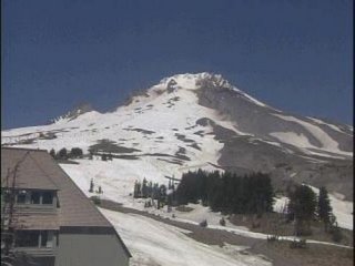
Skiing across California's High Sierra is a dream of most ski mountaineers, and the route from Mammoth Mountain to Yosemite Valley is one of the most popular. We began our journey on a beautiful bluebird day, donning our packs and skinning up at the base of a ski lift next to
Mammoth Mountain Resorts main lodge. Skinning up a groomed run next to a ski lift while carrying a full pack garnered us some strange looks from skiers heading downhill, the more traditional direction at the resort, but we soon turned off the groomed run and left the crowds behind as we climbed toward Minaret Summit.
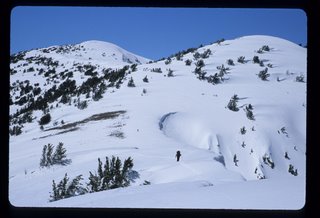
Reaching Minaret Summit, the familiar granite faces of the jagged Minarets, Mount Ritter and Banner Peak welcomed us home to
Ansel Adams Wilderness, a favorite summer haunt. Continuing up San Joaquin Ridge, we opted for the wind-scoured East side over the wind-loaded and heavily corniced West side, a decision that kept us relatively safe from avalanches but required carrying our skis over a few rocky sections. We ended our first day with some sketchy turns on breakable crust, finally descending to a level camp just as the sun disappeared behind Mount Ritter and Banner Peak.
We woke to find Mount Ritter and Banner Peak bathed in the golden glow of the sunÂs first rays. We quickly packed and enjoyed carving a few icy turns before reaching a sunny breakfast spot, where we watched the moon set behind the mountains as we planned our route for the day. We originally had planned to ski to Thousand Island Lake and then follow the summertime John Muir Trail route over Island Pass and up the Rush Creek drainage to Donahue Pass. But with several obvious avalanche hazards between us and Thousand Island Lake we opted for an alternate route instead.
The most logical alternative was to ski directly to Rush Creek, a long, gentle descent of over 1,000 feet followed by a long climb up the Rush Creek drainage to Donahue Pass. But loathe lose any of our hard-fought elevation, we instead tried to traverse to the head of the Rush Creek drainage without losing any elevation. By midday we had gained and lost thousands of feet, much of it over sketchy, steep terrain, and seemed no closer to our destination. Resigned, we skied down to Rush Creek and began the long climb to Donahue Pass, camping for the night just below tree line.
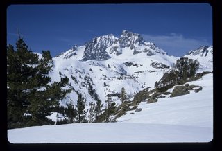
We began climbing with the sun the next day, and reached the top of Donahue Pass by mid-morning. Donahue Pass was icy, and we skied cautiously. But soon after we left the pass the ice softened into delicious spring corn snow. We harvested fresh corn turns all the way down, ample reward for two days spent mostly climbing.
The snow through Lyell Canyon was consolidated and fast. With virtually no avalanche risk, my long-suffering brother sprinted ahead to the
Tuolumne Meadows ski hut, leaving us to follow, once again, in his skin tracks. Periodically he stopped to carve messages to us in the snow. "BEAR!" he wrote, with an arrow pointing to unmistakable, freshly laid bear tracks we might otherwise have missed. "Sorry about the trees," read another message, shortly after a low hanging branch had clocked my husband in the forehead as he followed my brother's chosen path.
By the time we reached the Tuolumne Meadows ski hut, the sun had disappeared behind the clouds and my brother's ski tracks were slowly filling with fresh snow. Spreading our wet gear on spare bunk beds and along the clotheslines hanging from the rafters, we built a roaring fire in the wood-burning stove and quickly made ourselves at home. Our "neighbor" Bruce (one of the two Tuolumne Meadows winter rangers) dropped by during dinner, the only other person we saw during our trip.
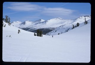
Skiing along a deserted, snow-covered Tioga Road the next morning was a surreal experience. In the height of summer, Tioga Road through Tuolumne Meadows is often lined with cars, trucks and motor homes, with cars and pedestrians stopped on the shoulder to view Lembert Dome, Unicorn and Cathedral Peaks, and other popular sights. But with piles of snow carpeting the meadow and covering the familiar granite domes and peaks, we had the entire road to ourselves.
We started under perfect blue skies, but the clouds began to roll in by mid morning and the temperature dropped noticeably. The good news was that the cooler temperatures meant that the notoriously avalanche prone Olmstead Point area would be less likely to slide. The bad news was that the early morning sun had already warmed the steep granite slopes to the sliding point, and with thick clouds now completely obscuring our view, we couldn't see the danger directly above us. But we could hear it.
Stopping momentarily to check our bearings with the GPS, we heard two small slides release nearby and quickly dropped below the road. Rejoining the road again at Olmstead Point, we stopped to get our bearings, resting under a tree immortalized by a famous Ansel Adams photograph of the area. With the weather deteriorating, we decided to press on to Yosemite Valley that night, making for a long, 24 mile day.
Leaving Olmstead Point, we followed Snow Creek as it slowly meandered its way toward Yosemite Valley, enjoying a few hard-earned turns as we went. Visibility remained minimal due to thick clouds and falling snow, and the snow turned to rain as we continued to lose elevation. Rain and slush rendered the glue on our skins completely useless, and we stopped briefly to stuff our soggy skins into waterlogged packs. Pushing on into the rain, we did not stop again until we ran out of snow at the head of the canyon.
Strapping skis to packs, we exchanged our heavy ski boots for lightweight Crocs and continued down the so-called Snow Creek Trail, more creek than trail due to the rain and the melting snow. The Crocs performed surprisingly well on the slippery trail, and seemed the perfect compromise between carrying much heavier trail runners or hiking boots or hiking in ski boots to avoid the extra weight. We quickly dropped below the clouds, where the imposing face of Half Dome reflected in the misty waters of Mirror Lake signaled that we were home.
