Mt. Timpanogos Dawn Patrol - East Ridge
Adventure Report: Backcountry Bob and I found a reason on Mount Timpanogos to not hang up the skis for the season.
When passing by the desk of Backcountry Bob yesterday all it took from him was
 a "What are you doing tomorrow morning?" to which I responded, "skiing Timp with you!"
One of the coolest aspects of working at Backcountry.com is that there is never a shortage of backcountry skiing/climbing/trail running/mountain biking partners. If you want to climb a certain mountain the likelihood of someone else sharing the same passion is in your favor. Chances are that someone else could be your manager. If it's not, having managers that will let you get after in the outdoors while adjusting your schedule a bit to accommodate is key.
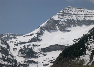
Mount Timpanogos is the second highest peak in the Wasatch
 Mountains of Utah but more importantly is that it holds more lines to climb and ski than you could undertake in one season. It's a MASSIVE mountain stretching for 4-5 miles North to South.
Our goal was to ski the East Ridge, a strikingly beautiful ridge that I've coveted for at least 6 years. We met up at 5am and made the drive to Timpanogos, ascending the Primrose Cirque above Sundance Resort.
We started booting up the cirque but switched over to climbing skins and then back and forth as the climb became steeper in some sections and more mellow in others. Up the Timp Glacier we went to the
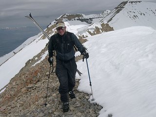
 summit saddle after which we turned left towards the second summit. The final portion of the summit ridge that leads to the East ridge was a rocky scramble with a huge cornice stretching out over the top of Cascade Cirque.
We down climbed about 15 feet from the summit of the East ridge and started skiing. The upper 2000' of the ridge is between 35-42 degrees in angle but in the near perfect snow condition s we had the angle wasn't a factor. We descended the ridge section by section avoiding the spattering of cliff bands that dictate your every move. Views of Utah Valley, Mount Nebo to the south and the Uintas to the east were savored as we descended into an area of the Wasatch that seldom sees visitors, particularly in the winter.
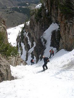
Near the bottom of the ridge you have to navigate skiers right through a chute to avoid the final major cliff band. Bob made easy work of this chute after which he opened it up, enjoying high speed GS turns on lower angle slopes that feed into the final obstacle of the descent - the tube.

The tube is a very narrow chute that exits Big Provo Cirque and the lower flanks of the east ridge near the popular summer hiking destination of Stewart Falls where a trail would lead us to the Aspen Grove parking lot where we began our day. Although the snow reaches the consistency of a slurpie it was enjoyable and challenging navigating the tube and the slopes below.
A quick hike out, a 45 minute drive to the office followed by a quick change of clothes (not to mention a heavy dose of deodorant) and it's "business as usual" for the two of us. Another day in the life of a Backcountry.com employee. 0 comments


0 Comments:
Post a Comment
<< Home